


01 Westmoreland Voting District, Sumner County, Tennessee
About
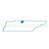
Outline

Summary
| Unique Area Identifier | 669842 |
| Name | 01 Westmoreland Voting District |
| County | Sumner County |
| State | Tennessee |
| Area (square miles) | 71.81 |
| Land Area (square miles) | 71.79 |
| Water Area (square miles) | 0.02 |
| % of Land Area | 99.97 |
| % of Water Area | 0.03 |
| Latitude of the Internal Point | 36.56163560 |
| Longtitude of the Internal Point | -86.26806280 |
Maps


Graphs
Select a template below for downloading or customizing gragh for 01 Westmoreland Voting District, Sumner County, Tennessee


Neighbors
Neighoring Voting District (by Name) Neighboring Voting District on the Map
- 01 North Sumner Voting District, Sumner County, TN
- 03 Bethpage Voting District, Sumner County, TN
- 5th Templow Voting District, Trousdale County, TN
- 8th Willard Voting District, Trousdale County, TN
- Cross Roads Community Center Voting District, Macon County, TN
- Westside School Voting District, Macon County, TN
Top 10 Neighboring County Subdivision (by Population) Neighboring County Subdivision on the Map
- District 3, Sumner County, TN (12,840)
- District 1, Sumner County, TN (12,031)
- Adolphus CCD, Allen County, KY (3,291)
- District 3, Macon County, TN (1,135)
- District 11, Macon County, TN (1,017)
- District 20, Macon County, TN (992)
- District 8, Trousdale County, TN (877)
- District 5, Trousdale County, TN (822)
Top 10 Neighboring Place (by Population) Neighboring Place on the Map
- Hartsville/Trousdale County, TN (7,870)
- Westmoreland town, TN (2,206)
- Bethpage CDP, TN (288)
- Bransford CDP, TN (170)
- Fairfield CDP, TN (131)
Top 10 Neighboring Unified School District (by Population) Neighboring Unified School District on the Map
- Sumner County School District, TN (160,645)
- Macon County School District, TN (22,248)
- Allen County School District, KY (19,956)
- Trousdale County School District, TN (7,870)
Top 10 Neighboring State Legislative District Lower Chamber (by Population) Neighboring State Legislative District Lower Chamber on the Map
- State House District 44, TN (70,843)
- State House District 46, TN (68,934)
- State House District 40, TN (60,137)
- State House District 22, KY (46,341)
Top 10 Neighboring State Legislative District Upper Chamber (by Population) Neighboring State Legislative District Upper Chamber on the Map
- State Senate District 18, TN (222,166)
- State Senate District 17, TN (208,424)
- State Senate District 9, KY (112,974)
Top 10 Neighboring 111th Congressional District (by Population) Neighboring 111th Congressional District on the Map
Top 10 Neighboring Census Tract (by Population) Neighboring Census Tract on the Map
- Census Tract 901, Trousdale County, TN (5,390)
- Census Tract 201.02, Sumner County, TN (4,959)
- Census Tract 9704, Macon County, TN (4,179)
- Census Tract 206.02, Sumner County, TN (3,891)
- Census Tract 201.01, Sumner County, TN (3,322)
- Census Tract 9206, Allen County, KY (3,291)
- Census Tract 206.01, Sumner County, TN (3,217)